GPS data is helping shape the Waikato region's active spaces
How do we know if our parks, sports fields and recreation spaces meet the needs of our communities? And how can councils make better decisions about where to invest in the future?
We are helping answer these questions through GPS-based movement data, revealing valuable insights into how people use our region's active spaces, where they're travelling from and how long they're staying.
Through our Waikato Regional Active Spaces Plan (WRASP), we work with data partner ActiveXchange to help councils better understand their spaces and make more informed planning and investment decisions.
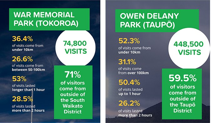
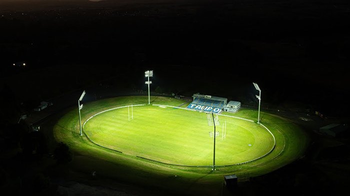
Recent analysis of 2025 data from South Waikato and Taupō highlights the role some facilities play beyond their local communities. As the figures below show, both Tokoroa’s War Memorial Park and Taupō’s Owen Delany Park attract substantial use from people living outside their districts.
But it's not just about visitor numbers. This data helps councils and partners better understand the problem they are trying to solve and choose an appropriate response.
A well-used space may need additional investment, while another may have capacity that could be unlocked through better programming, accessibility or activation.
Looking at data across a wider network helps reveal these patterns. Understanding these patterns helps shift planning from assumptions towards evidence and these insights are helping councils understand which spaces serve local communities, which attract regional visitors and where future investment could make the greatest difference.
Taupō District Council is already using the information to support reserve management planning, improve community understanding and help identify suitable locations for future facilities.
This evidence can support and inform priorities within Parks and Recreation Strategies and Action Plans (PARS), Long Term Plans, Reserve Management Plans and wider recreation and facility planning.
For us, the value lies in moving beyond assumptions to evidence-based decisions, ensuring existing spaces are better utilised and future investment responds to community needs.
Because better planning isn't always about building more. It's about understanding what we already have and how we can make it work better for everyone.
View the full case study
Explore our full Spaces & Places Case Study to see how GPS movement data is helping councils make smarter decisions about parks, recreation spaces and sports facilities across the Waikato region.